Derek Thomas, 3D fly through using ArcGIS ArcScene
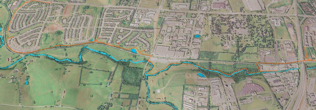
Justin Holt, Interactive 3D map using QGIS and Qgis2threejs
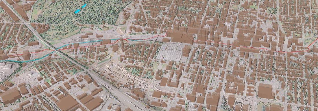
Lucas Mullins, Interactive 3D map using QGIS and Qgis2threejs
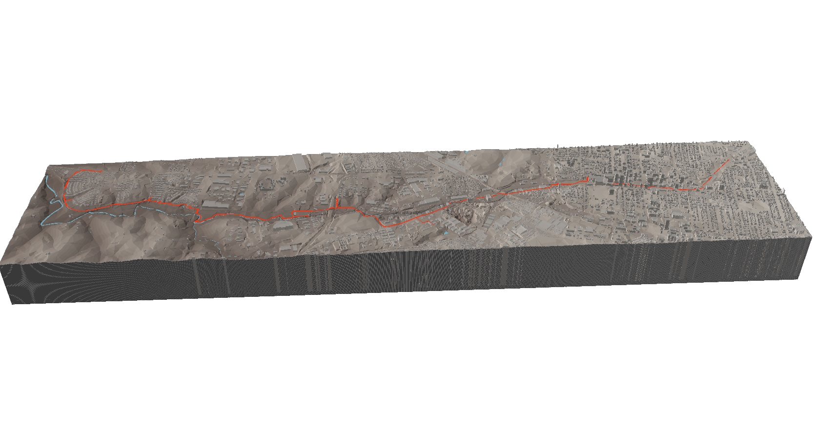
Alex Vogelgesang, 3D view using ArcGIS ArcScene
Mitchell Boles, 3D fly through using ArcGIS ArcScene
Images from McConnell Springs, Aaron Trejo
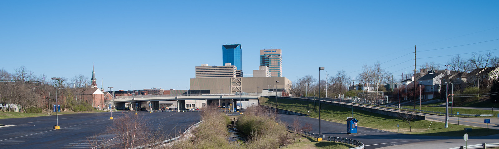
Images from the Vine Street corridor, Chris Woodward
Photographs of trail under New Circle and future overlook, Joe Brenzel
Distillery District, Jared Fairchild
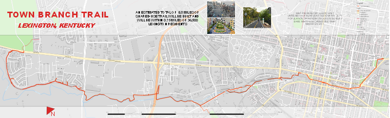
Photographs around Rupp Arena, Chad Goodrich
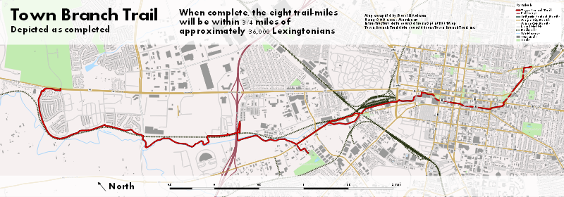
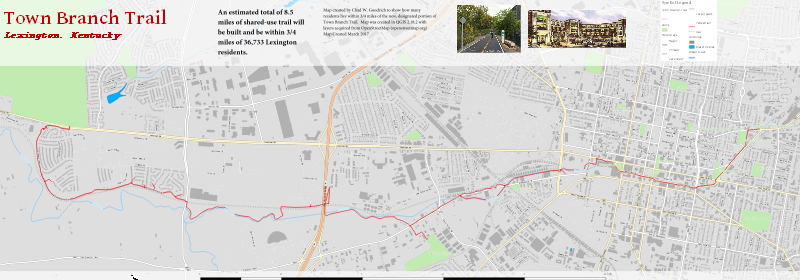
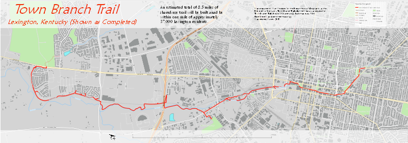
Images along the future Town Branch Trail, Tanner Polen
The history of McConnell Springs, Zach Major
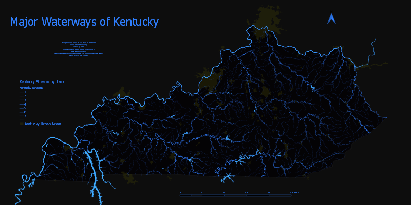
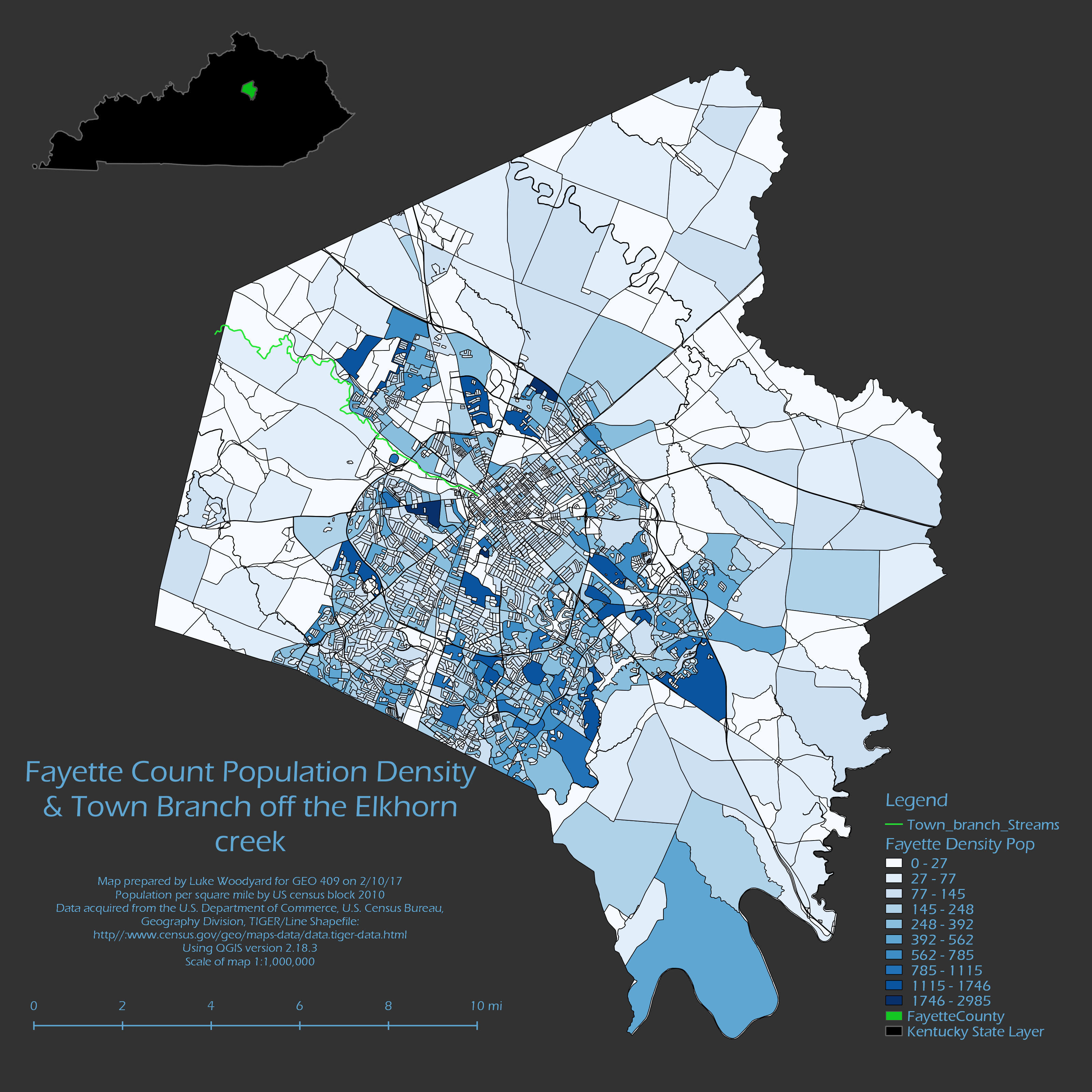
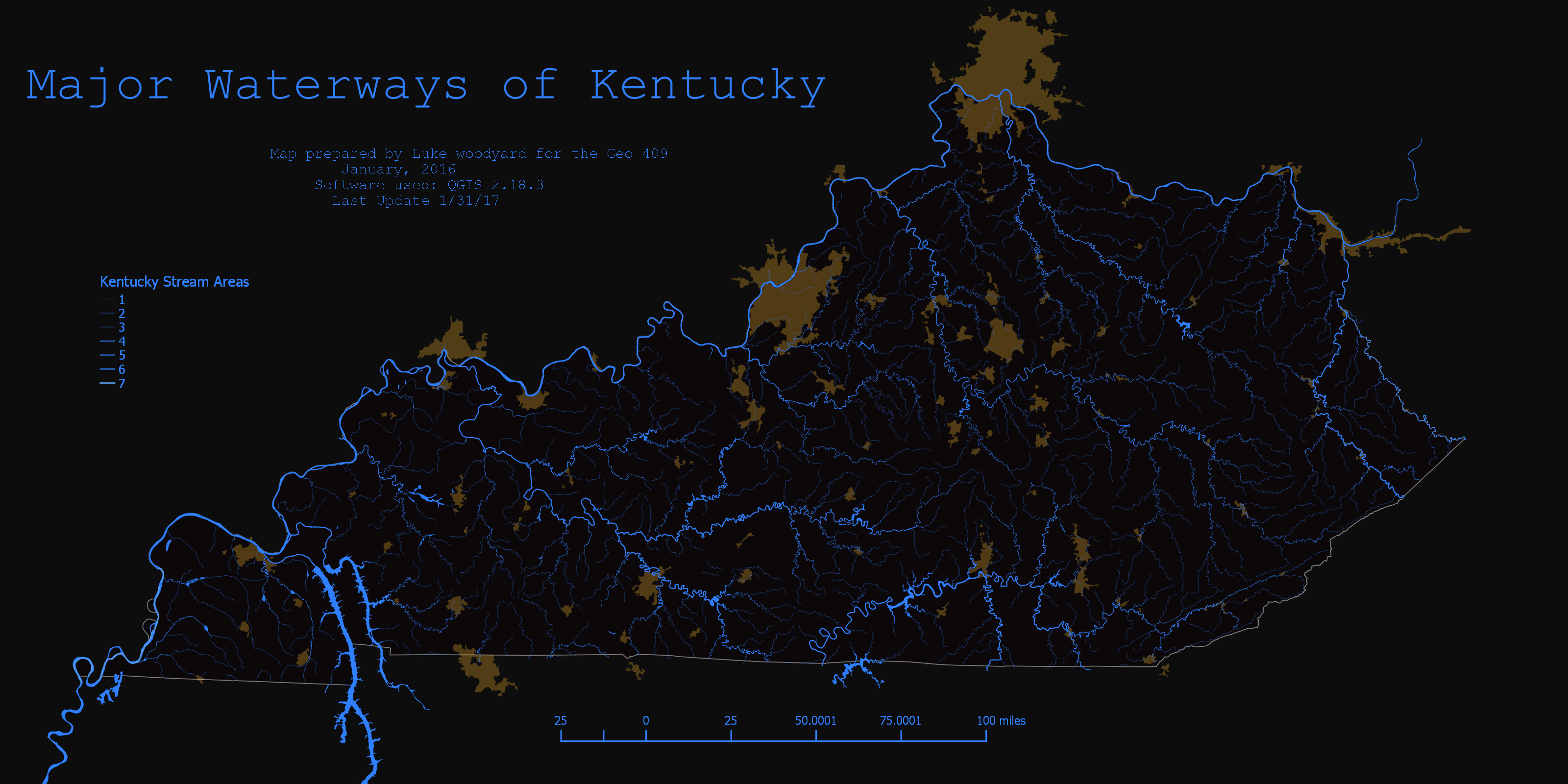
The history of Town Branch, Priyank Ghosh
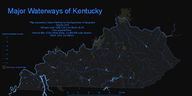
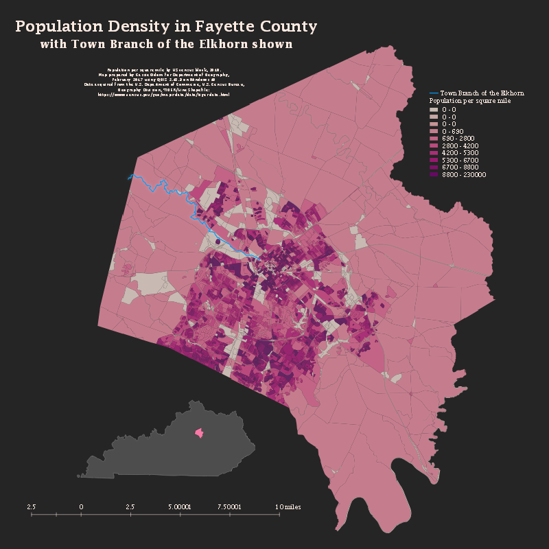
Lewis Manor of Town Branch, Coleton Martinez
History of the Distillery District, Matthew Medders
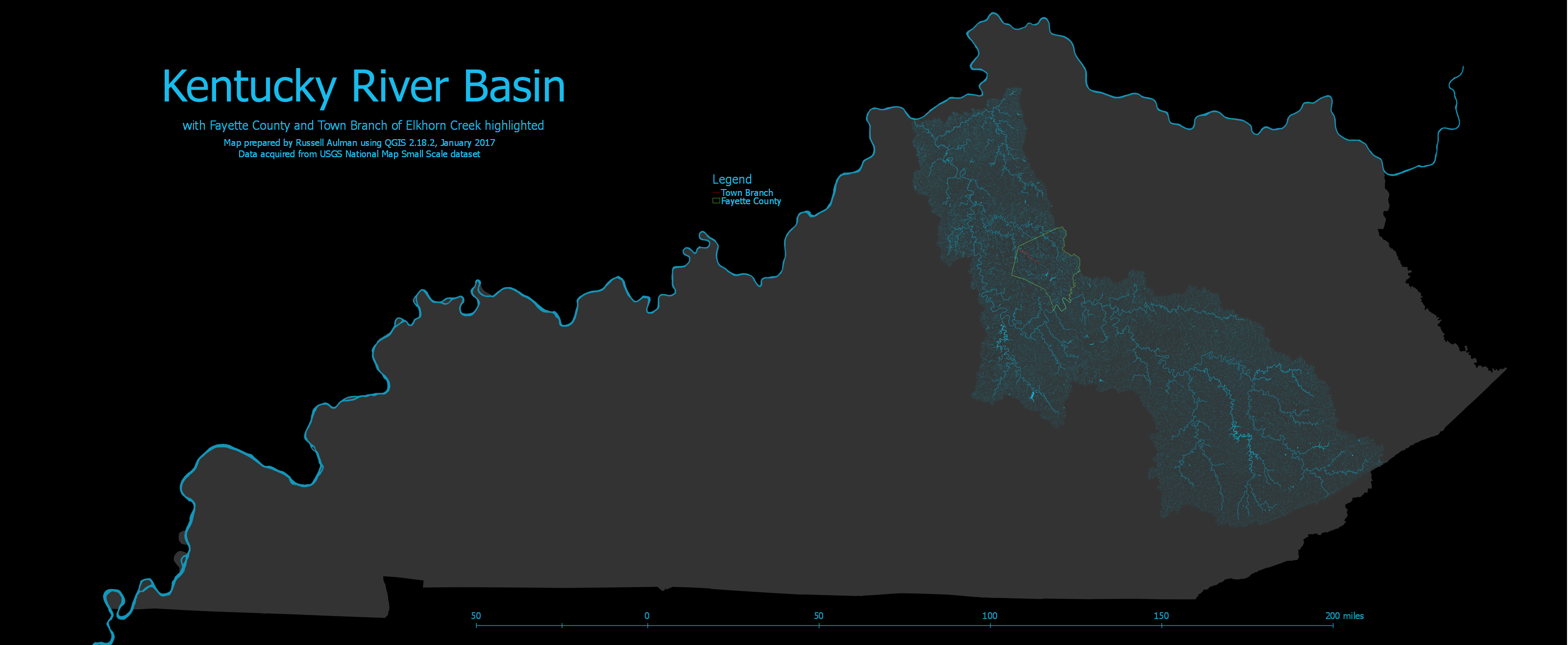
Russell Aulman
Jared Fairchild
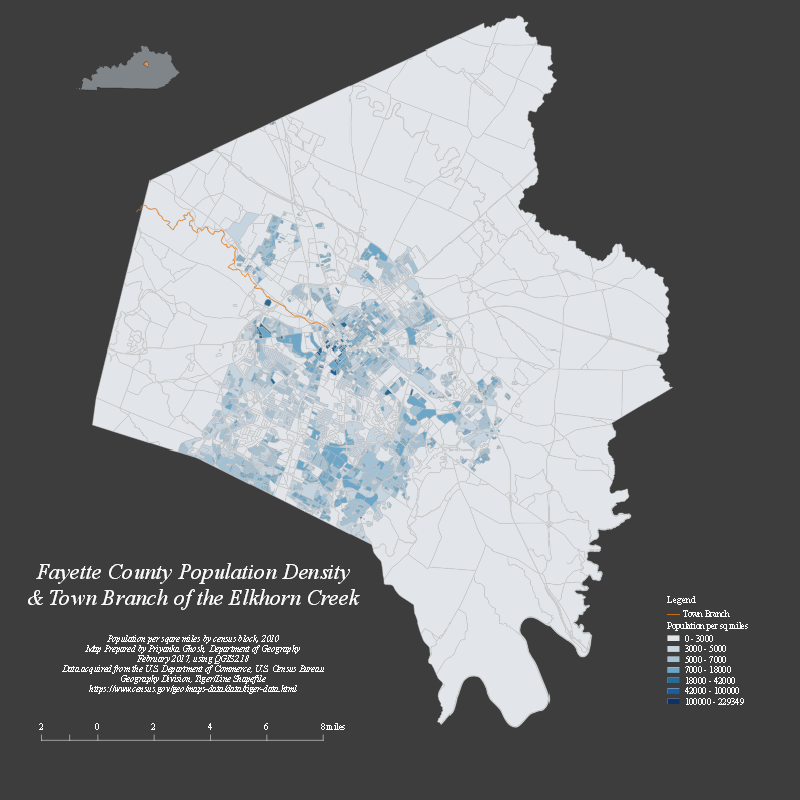
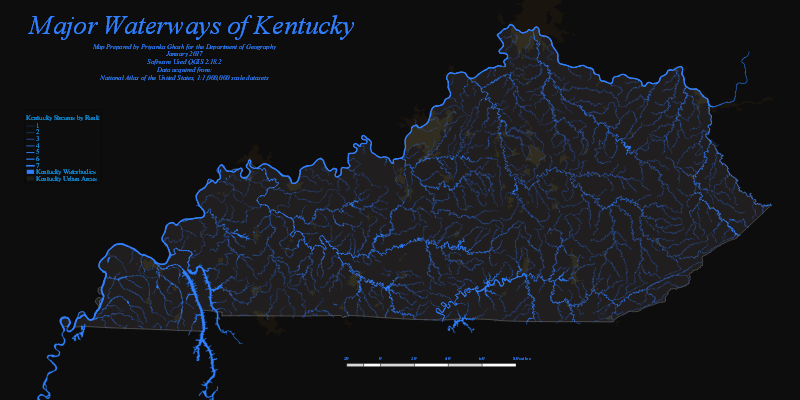
Priyanka Ghosh

Chad Goodrich
Justin Holt
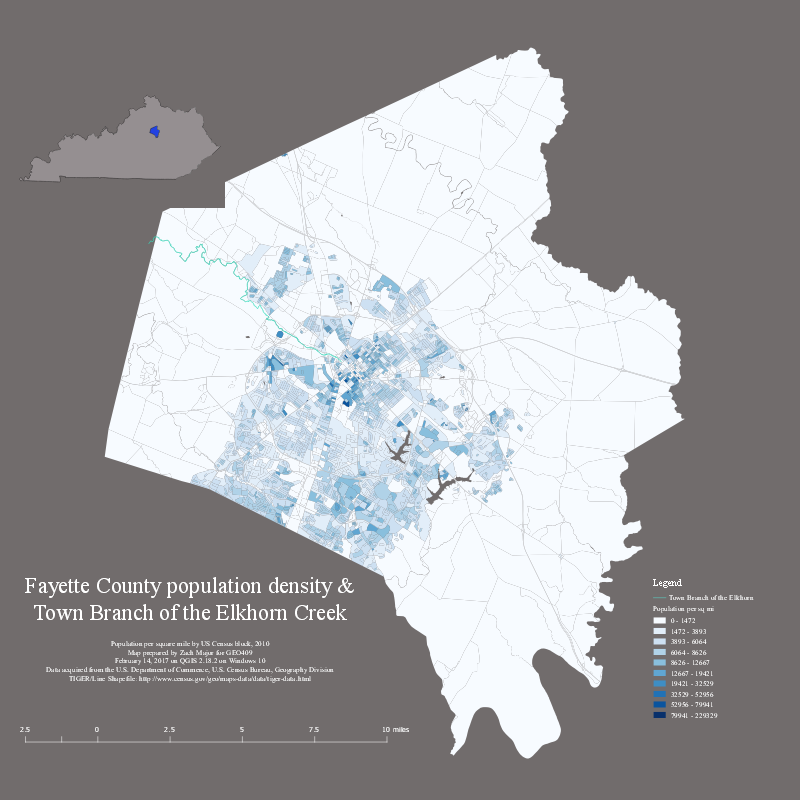
Zach Major
Coleton Martinez
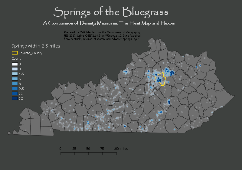
Matthew Medders
.png)
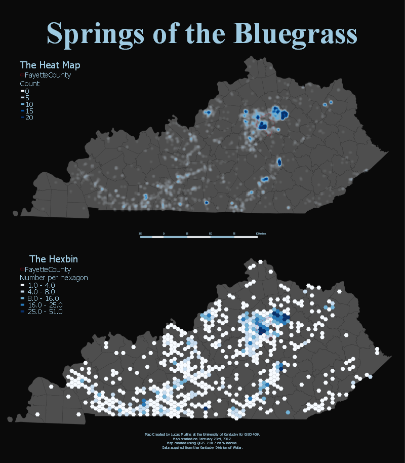
Lucas Mullins
Lucas Mullins
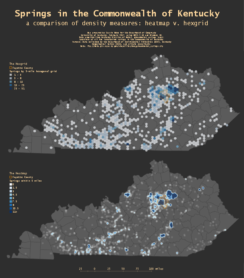
Cassie Odom
Tanner Polen

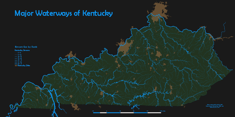
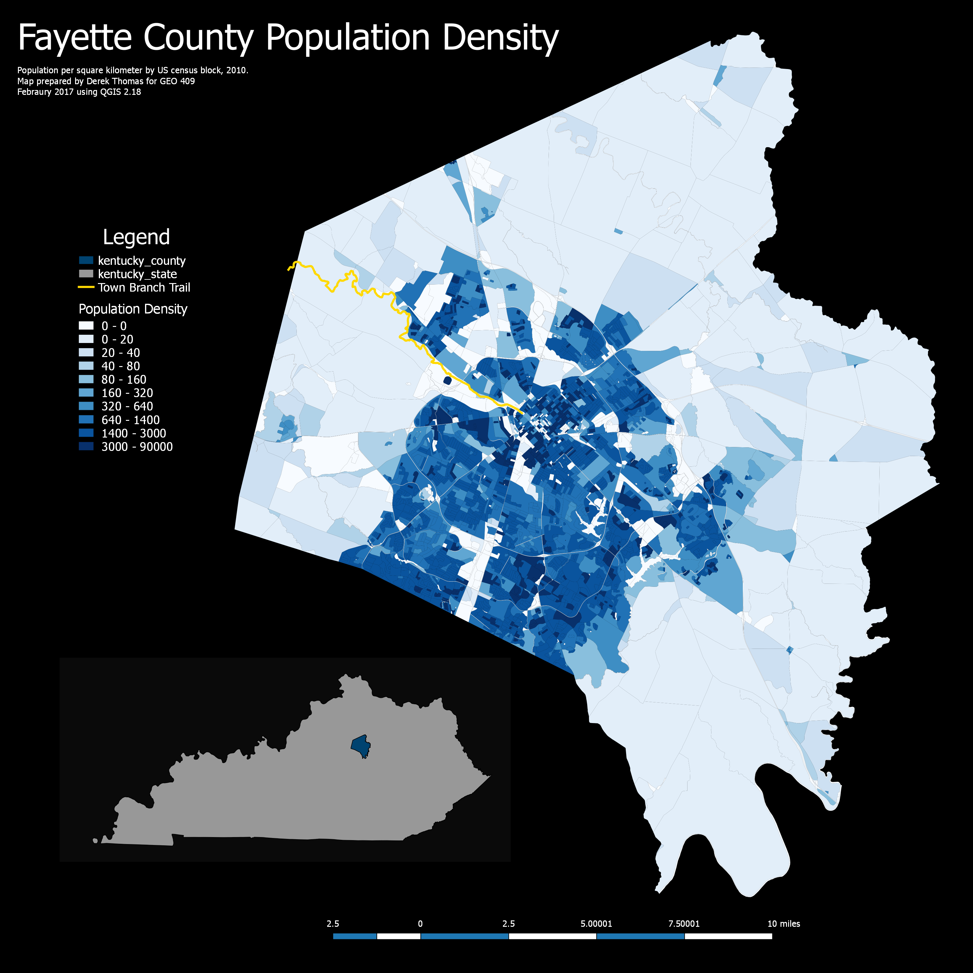
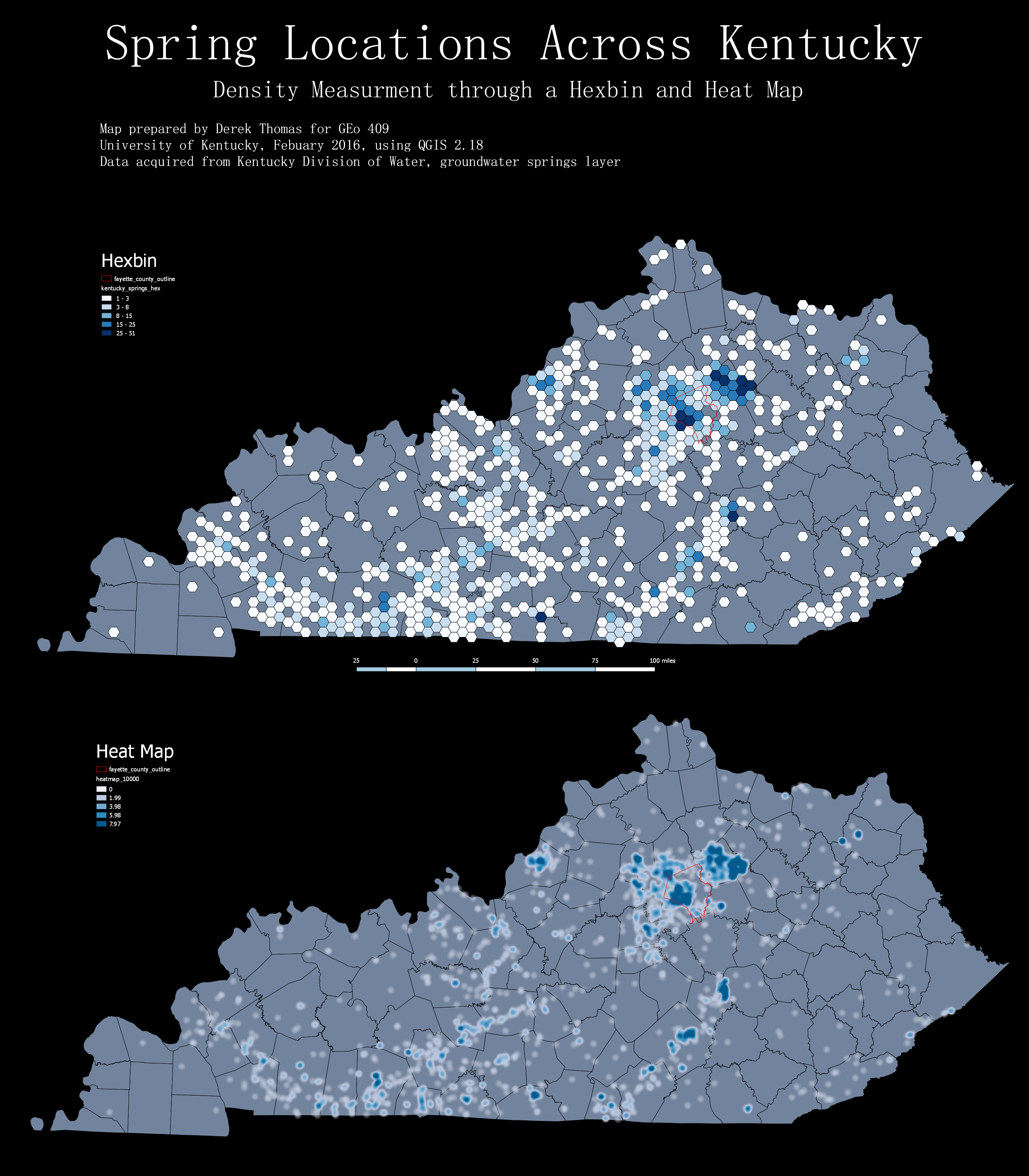
Derek Thomas

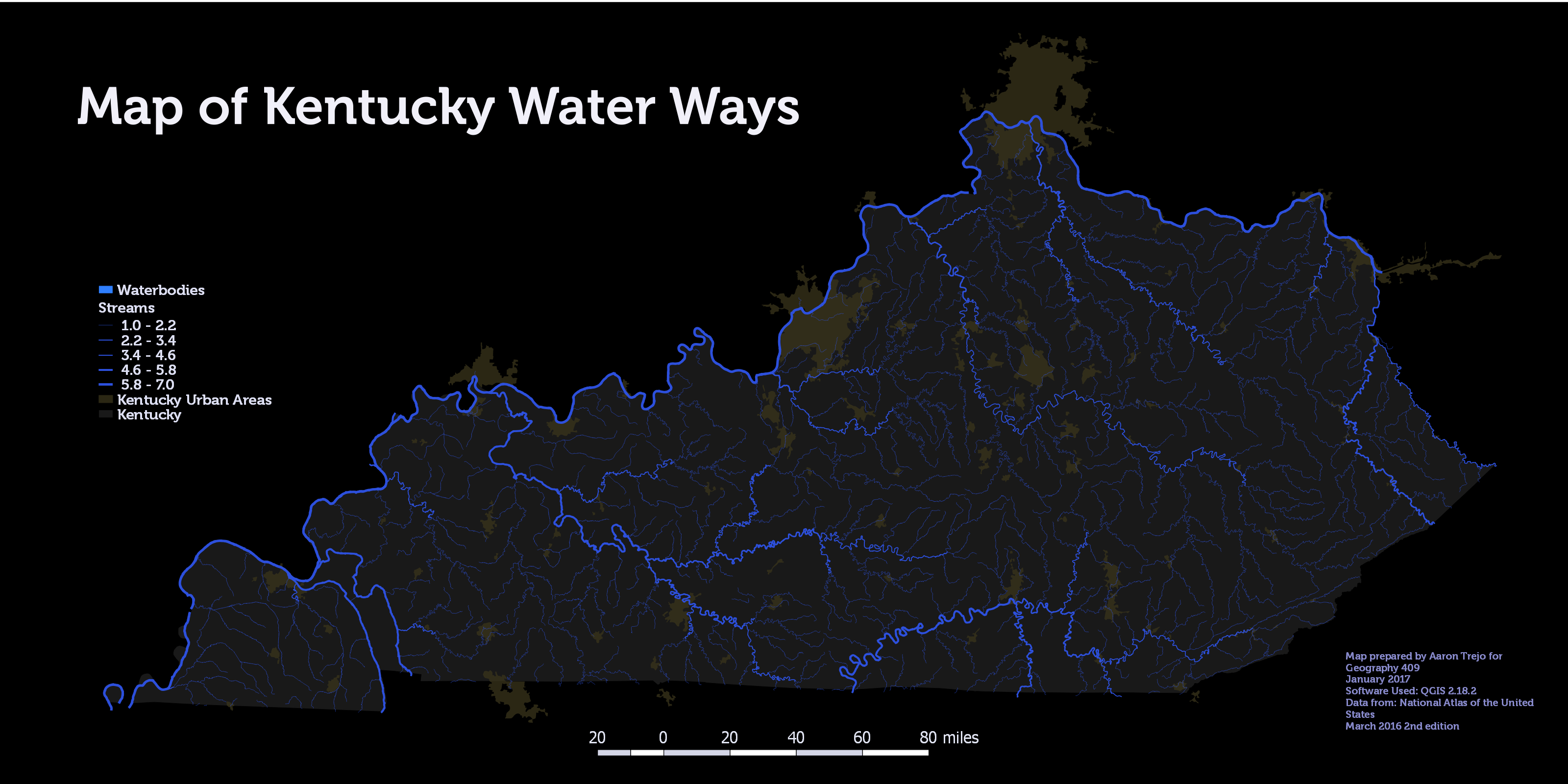
Aaron Trejo
.png)
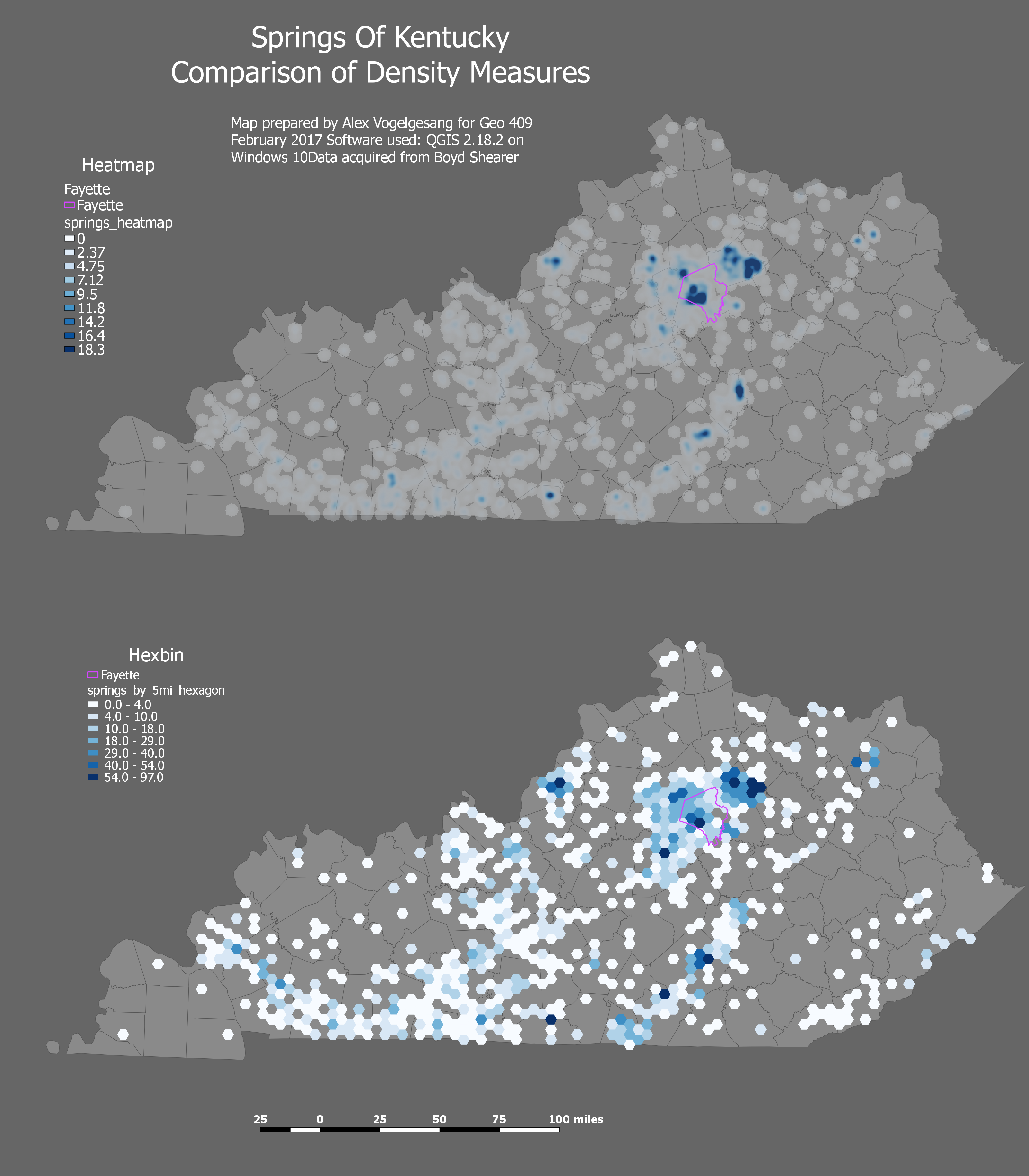
Alex Vogelgesang

Chris Woodyard
An exploration of Town Branch Trail in maps, photos, and research for GEO 409 (Spring 2017) at the University of Kentucky Department of Geography.
Live site at https://reece2ke.github.io/geo409_site. Peace out.
.png)
.png)